 9 hours ago
1
9 hours ago
1
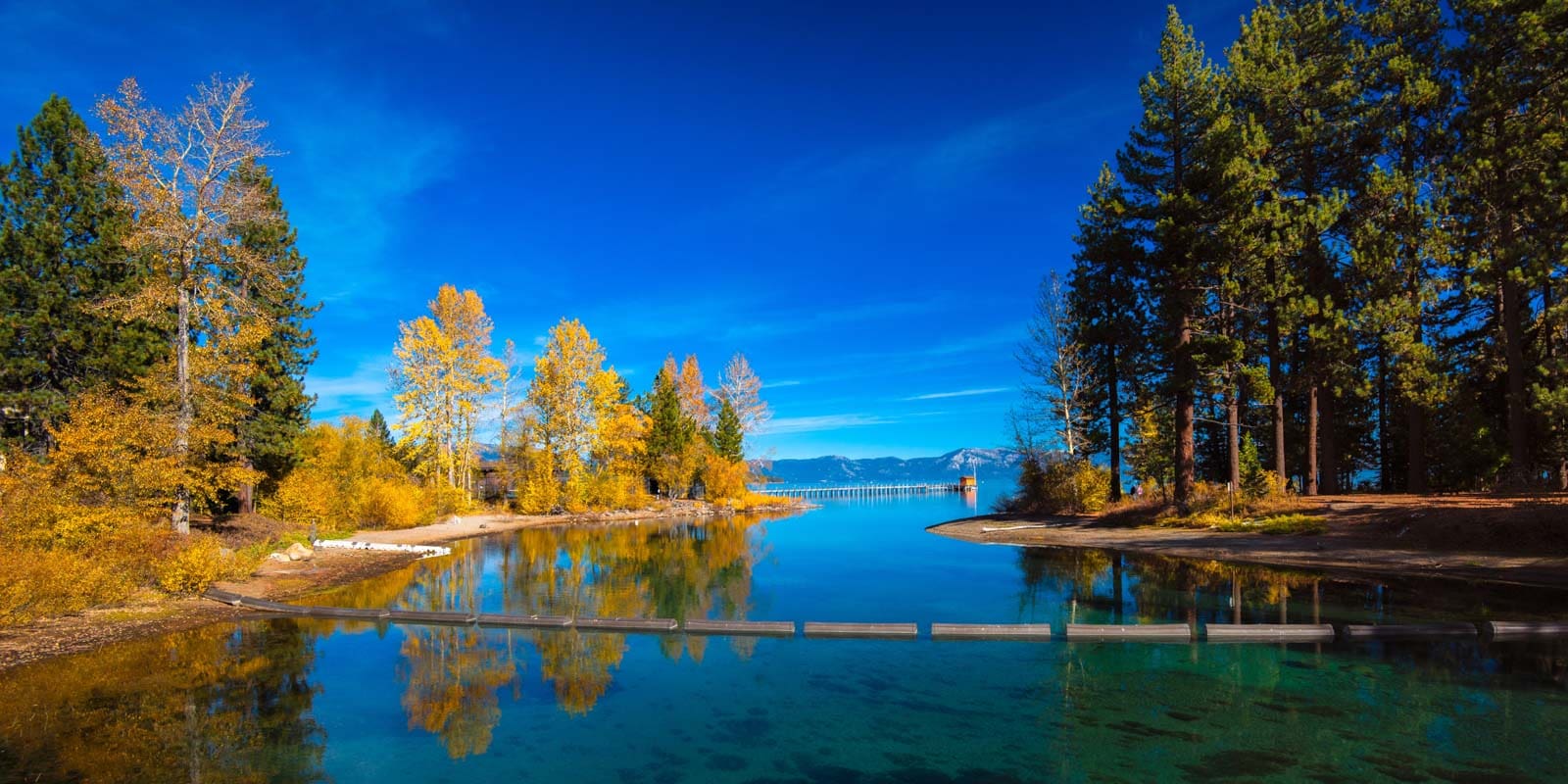
The loop of about 650 kilometres (400 miles) that begins in Liberia, loops down around the Nicoya Peninsula, and then comes up through the Guanacaste Mountains is widely considered the “master route” for sightseeing in Costa Rica. That’s because it covers the country’s three major terrain types: beaches, rainforests, and mountains.
I traveled the route recently via mountain bike after flying into Liberia’s international airport. I was extremely impressed with how much “bang for my buck” I got in terms of geographical and scenic diversity, from the rolling plains and tiny beach towns of the Nicoya Peninsula to the misty rainforests and thundering waterfalls of the Guanacaste range.
Each of the biomes I passed through on the trail was amazing in its own way, and they were all very distinct so I never felt the scenery got repetitive.
Although I travelled by bike, you could travel the route in any number of ways. In fact, I’d recommend travelling by other off-road vehicles like quad-bike or Jeep for at least part of the route to keep from getting exhausted.
In this guide, I’ll plot out the exact route and divide it into 10 distinct sections, providing a mix of personal observations and practical tips for each. After reading, it should be easy for you to plan your own action-packed Costa Rican adventure on the loop.
Mapping the route
I’ve divided the loop into 10 segments, each with a suggested start point and end point shown on the map below. Below the map, I’ll talk briefly about each segment, including information about it like the timeframe I suggest you travel it*, where to stay along the way or at the end of the segment, and good landmarks to check out.
Also, before I begin the actual itinerary, I want to restate a saying I heard from locals a few times during my time in Costa Rica that’s very relevant to those traveling during the sometimes-rainy months of May-November: “No deje para mañana lo que puede hacer hoy, porque mañana llueve”, which translates to “don’t put off until tomorrow what you can do today, because tomorrow it will rain”.
In terms of practical application to this route, that means you should start rides early, plan waterfalls or outdoor activities in the morning, and don’t assume the same sunshine will hold until late day.
*For instance, if I write that the “recommended timeframe” for a certain segment is “days 5 and 6”, that means you’d be covering that segment on days 5 and 6 of your trip if you’re following the itinerary I’m suggesting. Of course, the days you spend on each segment may be more or less depending on your pace or your personal preferences.
Note: This route is heavily based on bikepacker.com’s “La Gira de Costa”.
Off along the Nicoya Coast
Getting to the Nicoya Coast (Liberia → Playa Hermosa)
This is one of the three segments on this loop I would recommend “skipping”. In other words, take a bus or private car to get it over with as quickly as possible. Most of this segment is paved highway, so the 35km drive should only take an hour by car.
Distance: 35km
Recommended timeframe: day 1
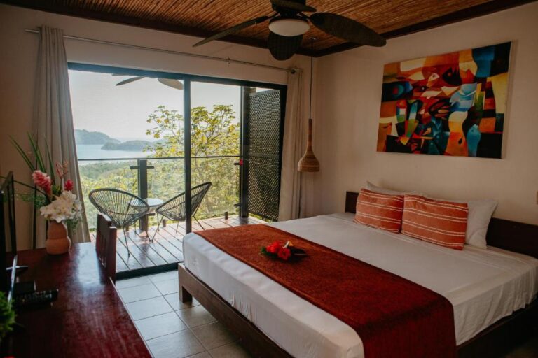
Where to stay: At the end of this segment, stay at a hotel in the town of Playa Hermosa and check out the nearby beaches.
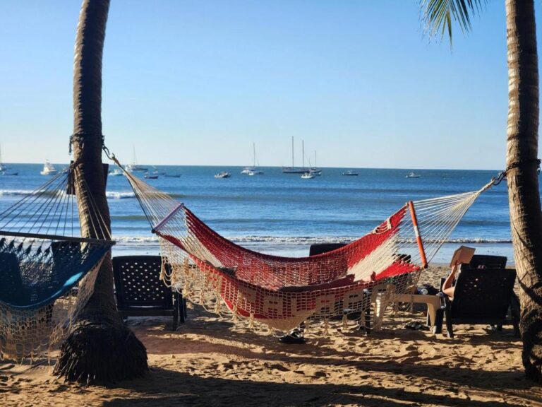
Northern Nicoya Peninsula (Playa Hermosa → Playa Garza)
This part of the peninsula has some awesome beaches with calmer waters than those further south. It’s also the most developed part, so the roads and beaches tend to be better-maintained than elsewhere. Because of the serene waters, wide beaches, and overall upscale vibe, the area has more tourists, especially families, than anywhere else on this route.
Despite the cleaned-up feeling, though, the northern peninsula is dry and arid. In fact, I remember thinking it felt closer to a desert area like northern Mexico than what I had expected from Costa Rica. Don’t worry if that’s the same feeling you have when you get there; the landscape of the northern coast is different from what’s to come.
Also don’t be alarmed by the frequent light honks you’ll likely receive from other drivers on the road. I was at first, but I talked to a local in Tamarindo and was told the quick beeps are a local behavior meant as friendly hellos.
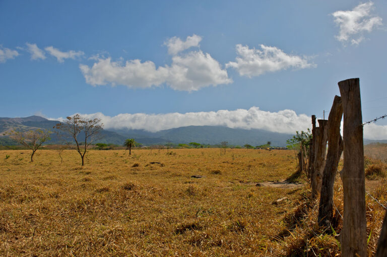 Dry and arid Guanacaste — Costa Rica isn’t always jungles!
 Distance: 119km
Recommended timeframe: days 1 and 2
Where to stay along the way: Tamarindo
This spot merges the social energy of a hostel with the comfort and privacy of glamping and it’s just a 5-minute walk from Tamarindo Beach
Lovely rustic and unspoiled boutique hotel close to local shops, restaurants, and adventures like Playa Conchal & sunset cruises
Set amid lush tropical gardens, this intimate stay has two pools, a beach garden, and an open-air restaurant, La Plumeria
 A coastal pause at Hotel La Palapa
What to do/see along the way:
- The incredible beaches – Even more so than the rest of the Nicoya Peninsula, the beaches in this stretch are the main attraction. They’re wider and better-developed than any other beaches in the country; I’d recommend actually riding on the sand when you can to immerse yourself in the beach atmosphere, especially at low tide when the sand is hard-packed.
- Playa Buena – I’m not spotlighting any other specific beaches on this itinerary since the coast has a million nice ones, but Playa Buena (which is actually just north of Playa Hermosa) is my favorite. I heard from local guides that it’s a hidden gem, and I wasn’t disappointed; it’s a black sand cove with a wilderness feeling that’s rare in the area. I also hear it has some absolutely amazing snorkelling, with eagle rays and Hawksbill turtles. There’s a resort called Occidental Papagayo just down the beach, but Costa Rica has a law that all beaches have free public access
- Nosara biological reserve – Near the end of this leg, there’s an incredible wetland sanctuary with well-marked trails that lead through mangroves to see howler monkeys, iguanas, and colorful birds. You need to buy a guided tour for $25/person.
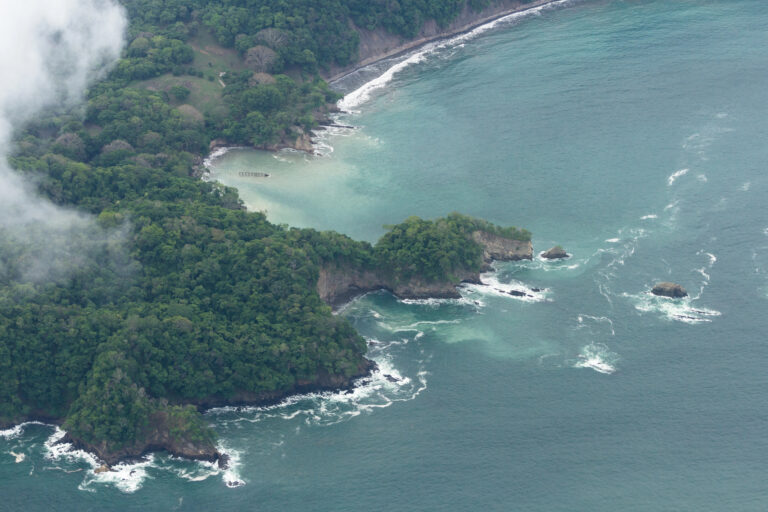
Central Nicoya Coast (Playa Garza → Santa Teresa)
As I passed Playa Garza, the dry and desert-like atmosphere of the Northern Peninsula gradually gave way to a lush green jungle vibe that I had associated with Costa Rica before my trip.
The roads got narrower and less of them were paved. I began to fancy myself an Indiana Jones-like character cycling along vine-choked dirt tracks, and the fact that my surroundings were getting noticeably less touristy only added to the illusion.
The wildlife sightings picked up too. I hadn’t seen much wildlife along my route on the Northern Peninsula, probably because of more development and a generally higher population.
Starting with this stretch, though, I began to see howler monkeys hanging out in trees, iguanas sunning on rocks, and coatis (animals I mistook for anteaters for most of my trip) pawing the dusty ground. Those chance wildlife sightings were my favorite part of the journey, and I’d advise you to stick to unpaved backroads as much as possible if you want to experience them.
Distance: 95km
Recommended timeframe: days 3 and 4
Where to stay along the way: Punta Islita – Stay at this one-bedroom apartment, just minutes from the beach, featuring a private balcony with ocean views, air conditioning, a kitchenette, Wi-Fi, and free parking.
What to so/see along the way:
- Horse jungle – Riding through on horseback has a way of making any landscape feel more epic, so riding through the dense jungles and over the golden beaches of Costa Rica is an absolutely magical experience, especially if done at sunset. Horsejungle, located in Samara, offers horseback tours with fantastic service and reasonable prices. The 2.5 hour tour is $55/person.
- Belen Waterfalls – These multi-tier waterfalls have swimming holes at each level for swimming or wading in the midst of lush jungle scenery. It’s free and it’s a nice break from the beaches. The falls are a 25-minute drive north of Samara.
- The Macaw Recovery Network – This center near Punta Islita helps transition injured macaws back to the wild, and they offer tours of their reserve. The bright-red birds have funny mannerisms and the 90-minute tour is a blast. Make sure to schedule a tour in advance, and try to book one for the early morning since that’s when macaws are most active. Tours cost $25/person.
- Santa Teresa (end of this leg) – I absolutely loved this town and actually wrote a full-length Santa Teresa travel guide you can consult about all the things to do there. I’d recommend spending at least 2 nights there.
Southern Nicoya Peninsula (Santa Teresa → Jicaral)
The southern tip of the Nicoya Peninsula definitely felt like the most untamed, unforgiving, and honestly desolate part of the route’s coastal portion. The paradisical adventure movie atmosphere I had felt changed a bit; the rocky beaches, huge crashing waves, deep dark thickets of jungle, and extremely sparse settlements of people began to make it feel more like a post-apocalyptic thriller.
All that may sound like a bad thing, but I actually loved the abandoned, off-the-grid feeling of the area. If you’re travelling to Costa Rica, which is definitely an adventure travel destination, then I’d guess you may be the same way.
The wildlife became even more incredible here because of the fully intact tropical ecosystem. I saw animals that I hadn’t ever spotted outside a zoo, like white-faced capuchin monkeys and anteaters.
Distance: 90km
Recommended timeframe: days 7 and 8 (after a 3N2D rest period in Santa Teresa)
Where to stay along the way: Paquera
Small family-run jungle lodge with simple rooms, no AC but plenty of fan breeze, and balconies overlooking gardens or mountains
This stay puts you right in the depths of the jungle. It’s a family-run tent with mosquito-netted beds and the sounds of the forest.
Country-style retreat in rural Vainilla with a palm-lined pool, garden hammocks, and spotless air-con rooms
An eco-friendly hotel with epic views of Tortuga Island and the mountains, with an infinity pool, rooftop terrace, and free continental breakfast
 The views from a standard king room at Eco Boutique Hotel Vista Las Islas Reserva Natural
What to do/see along the way:
- Indigena Cafe & Chocolate – At the very southernmost point on this route is a cafe with delicious chocolate. You can tell this cacao was still on the vine in the near past from the cacao’s complex earthy flavour. The cafe’s decor is super-cool, too.
- Isla Tortuga Snorkelling Tour – Isla Tortuga is an uninhabited island beside volcanic reefs riddled with interesting topography rather than the flat coral beds you see at most snorkeling spots. And, most importantly, the aquatic wildlife is amazing: striped fish, moray eels, manta rays, sea urchins, and even the occasional sea turtle swim in the shallow water. I’d recommend the $65 Isla Tortuga snorkelling tour with Blue Line, which picks up from Santa Teresa but leaves from Montezuma.
- Anja’s Pura Vida Massage – You’re probably tired by now from the long and dusty trip along the coast (although, spoilers, the most strenuous part of the route is yet to come). So treat yourself with a massage here – spa treatments are $25-45.
Into the Guanacaste Mountains
Nicoya Coast → Guanacaste Mountains (Jicaral → Bagaces)
The road between Jicaral and Bagaces is the second of three “take it or leave it” sections in this itinerary.
This one’s actually not as boring as the sections at the start and end of the route – you can pass through some really bucolic and pretty wetland areas if you stick to the backroads. But the Peninsula and Guanacaste Mountain sections of the route are much more exciting, so I’d recommend just taking a bus or private car to get this leg over with as quickly as possible.
Distance: 130km
Recommended Timeframe: day 9
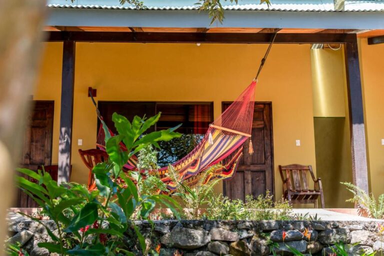
Where to Stay: At the end of this segment, stay at a hotel in the town of Bagaces. Bagaces has a very slow-paced and authentic Guanacaste vibe, so it’s a perfect place to rest up for the mountain portion of the route.
Guanacaste Foothills (Bagaces → Rinconcito Lodge)
This was the most grueling day of my bike trek, because it had by far the most uphill of any leg on this itinerary. It was also one of the most charming, though.
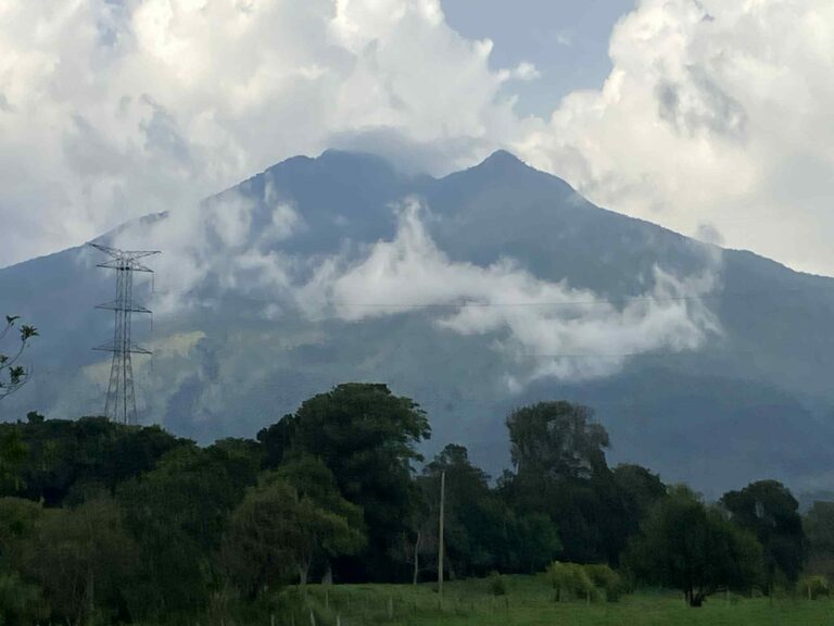
As soon as you head north from Bagaces, you’ll begin climbing. Looming high into the sky in the distance will be Miravalles Volcano, a usually mist-cloaked ancient behemoth that will act as the north star you can use to guide your expedition for the first part of this leg.
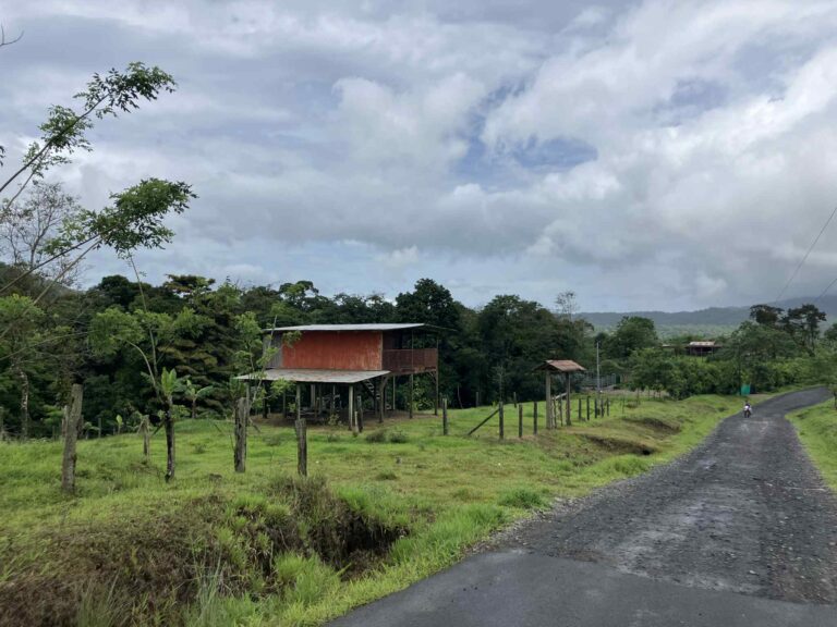
As you set out towards it, you’ll pass ranches with wooden gates, horses, and Brahman cattle grazing in unfenced pastures and lots of small streams cutting through the dry scrubland. I even saw a few sabaneros (Costa Rican cowboys) that looked straight out of a Sergio Leone film.
After the town of Salitral, the ascent gets extremely steep for the next 16km or so. During this stretch, the terrain turns from dusty trails to volcanic rock that’s actually a lot of fun to ride on. The ranchland scenery persists, but the settlements and small villages you pass through become more sparse because of the elevation.
I quite enjoyed the experience, though, to be honest, I was huffing and puffing a bit too hard to remember many specifics other than the ever-rockier terrain and the omnipresent buzzing of cicadas. I imagine it would be an incredible place to ride a quad-bike.
Distance: 32km
Recommended Timeframe: day 10
Where to Stay: The Rinconcito Lodge is a beautiful property, but I stayed in the nearby Rincon de la Gaetano for half the price and I’d recommend it.
What to Do/See Along the Way:
- Today is mainly a day for scenery + climbing the mountain. Enjoy the villages, schools, and volcanic foothill vistas you pass.
- Make sure to stay hydrated along this strenuous leg. There are lots of sodas (small Costa Rican restaurants) along the roadside, and you should stop to drink frequently.
 A warm corner at Rinconcito Lodge
Guanacaste Rainforest (Rinconcito Lodge → Santa Maria Volcano Lodge)
About 2km up the climb from Rinconcito Lodge, you’ll ride through a little gorge as the road crosses a small mountain stream. I still remember the feeling of the air changing over the next minute, from dry heat to warm and humid, almost sticky. This was the beginning of the rainforest portion of the ride.
Soon, I was in the thick of the forest, and it pervaded all of my senses.
Thick green walls hugged the trail on either side, with the only light being the green-tinted sunlight filtering through the canopy. The cicada sound from before was replaced by the blares of toucans, howler monkeys, and the drumming of woodpeckers on hollow tree trunks.
The scent of fermenting guava fruit and decaying leaves on the ground mixed with the odor of tree sap from up high to created a cacophony of aroma. I even felt like I could taste the syrupy-sweet air as I made my way through its gentle humidity.
There were also a ton of electric blue butterflies along the route that cut through the dim green light. They were the most common but also the most beautiful of all the wildlife I saw along that leg.
The rainforest remains thick for 5-10km, then gradually opens back up into hillier scenery and sunnier climate.
Distance: 15km
Recommended Timeframe: day 11
Where to Stay: I absolutely adored the Santa Maria Volcano Lodge and ended up staying there for 3 nights, checking out the surrounding area during the day.
What to Do/See Along the Way:
- Rinconcito Canopy Tour – Rinconcito Lodge offers a variety of tours; I recommend their Guanacaste Rainforest Canopy Tour, in which you get to zipline from tree to tree. It’s $45/person, and it offers a different perspective on the incredible surroundings than you can get from the ground.
Guanacaste Cloud Forest (Santa Maria Volcano Lodge → Dos Rios)
For the first 5-6km of this leg, you’ll enjoy the same temperate but sunny weather as at the end of the previous leg. After you pass the small town of Colonia Libertad, though, the air begins to shift, and so does the foliage.
At first, it feels like the wonderfully warm rainforest from the previous leg is making a return… until the sounds of wildlife from the surrounding trees begin to fade away, and a thick mist begins to wash over the road, and you realize you’re riding into a whole new type of magic.
Before long, the mist on the road was so thick that I could barely see through it – but I could certainly feel it, because the roads up that high are mainly unpaved and the cool moisture in the air made it slick under my tires.
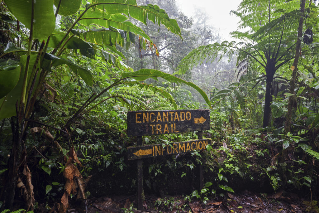 Encantado Trail through the lush Santa Elena Cloud Forest near Dos Rios
Which wasn’t a huge deal until the 8-mile stretch of steep uphill midway through the route; it was the most difficult part of the entire ride since I kept slipping on the hill. Plus, the whole time I had to keep my eyes glued to the road in front of me since I almost ran into cattle or a pack of dogs a few times. A quad-bike would have been seriously nice at that point. Even then, though, I wouldn’t risk going off-trail for fear of getting lost in the mist.
Inconveniences aside, the atmosphere of the cloud forest was immaculate. The mist created a cool, humid climate I had only ever experienced in caves, which made the ride feel like a fairy tale.
There was plenty of wildlife I hadn’t seen elsewhere on the ride – hummingbirds and hawk-eagles, kinkajous, ocelots, colorful tree frogs, huge ants marching up the trees, and colorful butterflies that made the ones I had seen in the rainforest seem tiny by comparison.
For whatever reason, though – maybe because sound travels less in heavy humidity – the sounds from the animals were quieter. The cloud forest persists until you crest the mountain, and drains away as you descend towards Dos Rios.
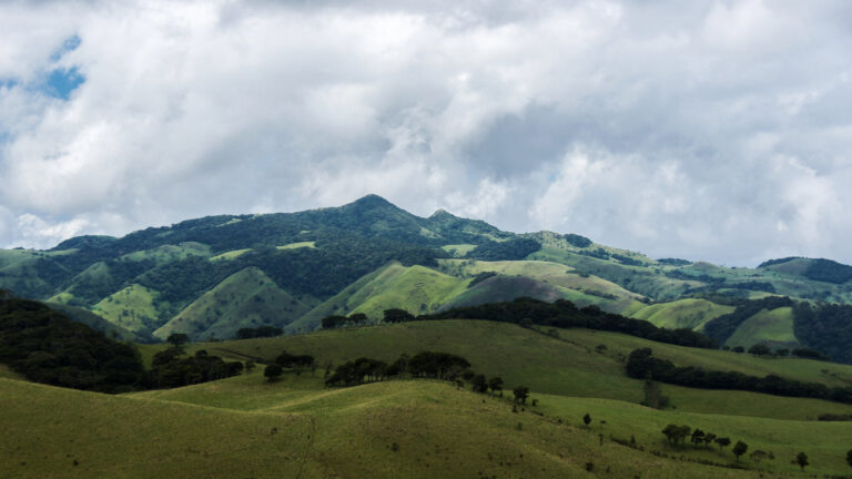 Meadows of Guanacaste
Distance: 28km
Recommended Timeframe: day 13
What to Do/See Along the Way:
- Colonia la Libertad Park – Near the beginning of the leg where the rainforest really opens up in the town of Colonia Libertad, this park is a fantastic place to stop for a rest and have a picnic under thee sun shelter before the ascent into the cloud forest.
- Dino Park Tour – It’s a bit cheesy, but it’s tons of fun and the rainforest setting really does make the dinosaurs in the midst of the jungle feel a bit more “real” than they otherwise would. The 2.5 hour walking tour costs $28/person and is one of the many tours at Blue River Resort, beside the town of El Galivan near the end of this leg.
- El Santuario Falls – Just north of El Galivan is a majestic waterfall. El Santuario Falls cost $10/person to enter, but the volcanic rock canyon setting and the turquoise plunge pools are well worth it.
Guanacaste Mountain Descent (Dos Rios → Balbo’s)
The first 10km of this leg have a few steep ascents where the trees open up and you can see valleys and farms splayed out beneath you. You’re so high up at this point that the air is still and quiet, and this final climb feels a bit anticipatory, like the final seconds of incline on a roller coaster before the plunge.
Then you crest that final ridge and you can FINALLY take your foot off the gas and enjoy the scenery on a glorious 15km downhill. You’ll feel the crisp, quiet mountain air slowly fade back to warm humidity and then finally back to the dry heat of the lowlands.
The quiet in the air will gradually give way to cicadas buzzing. You’ll fly by mountain villages, and then ranches and horses grazing, and finally lowland farmsteads. It feels like a step-by-step return to normalcy.
Balbo’s is a hotel located at the intersection with the highway.
Distance: 25km
Recommended timeframe: day 14
What to do/see along the way:
- Relax, enjoy the descent, and let the scenery change before your eyes, like a movie recapping your adventure in reverse!
Return to Liberia (Balbo’s → Liberia)
This is the final leg of the trip, and it’s just a congested stretch of highway. I’d highly recommend taking a bus or a private car.
Distance: 25km
Recommended timeframe: day 15
I hope my itinerary and experiences will give you a good jumping-off point for forging your own Costa Rican adventure. Of course, my route is just a suggestion – I encourage you to explore backroads wherever possible.


 English (US) ·